Please contact our reservations team to discuss your bespoke stay.
PAUL’S HIGHLAND TRIPS – YOUR ADVENTURES IN THE HIGHLANDS AWAIT
EMBARK ON A VARIETY
OF HIGHLAND ADVENTURES
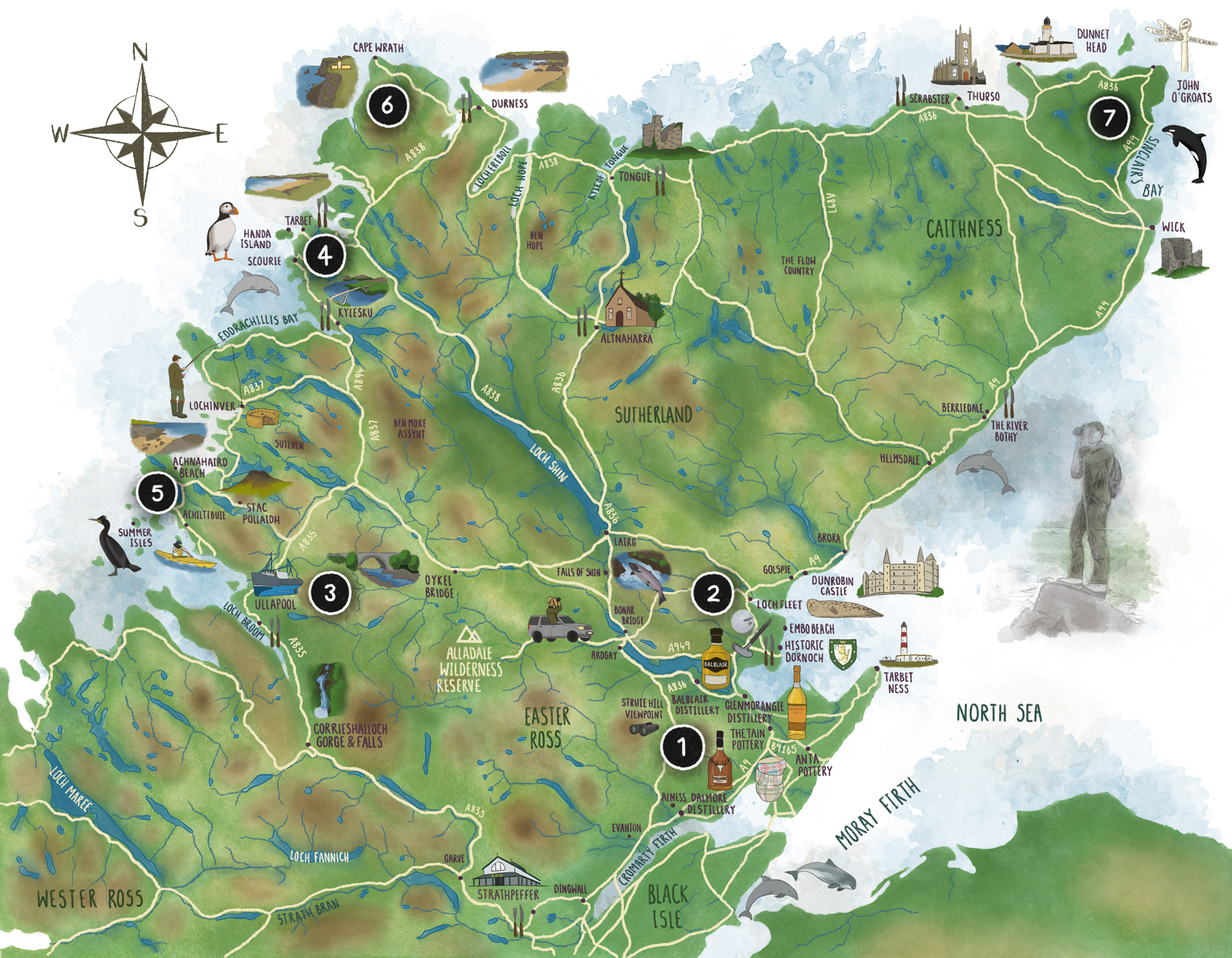
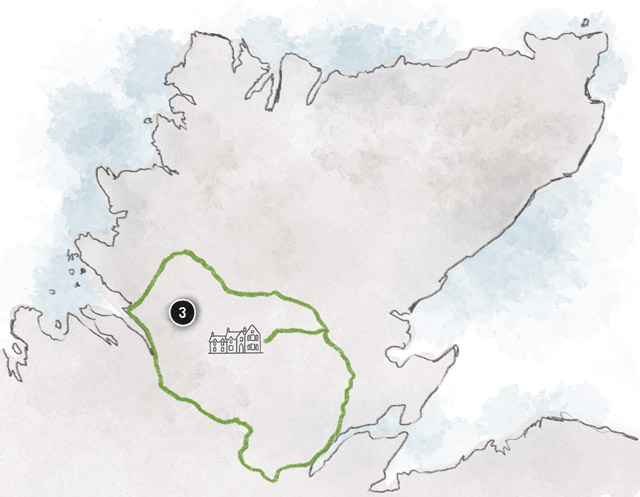
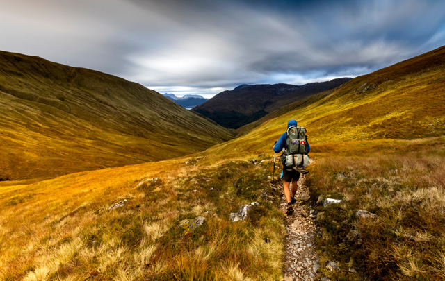
Located at the centre point of the Highlands, Alladale is the perfect place to explore the north of Scotland. While you’re here, immerse yourself in the surrounding landscapes and experience everything this breath-taking corner of the world has to offer.
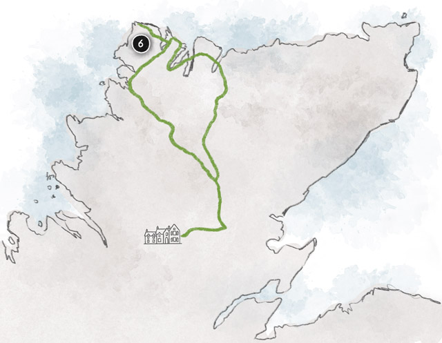
Paul, Alladale’s custodian has handpicked a selection of his ‘Highland Day Trips’ for our guests to enjoy a variety of experiences – whether you’re looking to stay closer to home or venture further afield for a long summer’s day out. To help guide you around Britain’s ‘Top End’, road maps are also available upon request.
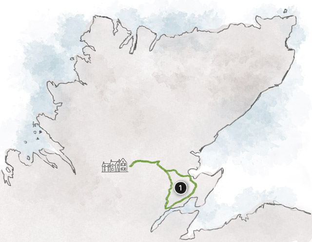
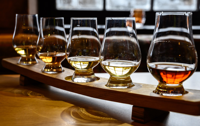
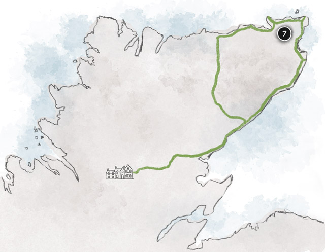
WHISKY TRAIL
For the whisky afficionados, make plans to visit the globally known Glenmorangie, Dalmore and Balblair distilleries. For lunch, choose from a number of restaurants in Tain or Dornoch.
In the afternoon, take a short trip to a pottery or walk out to Tarbet Ness Lighthouse.
88 miles
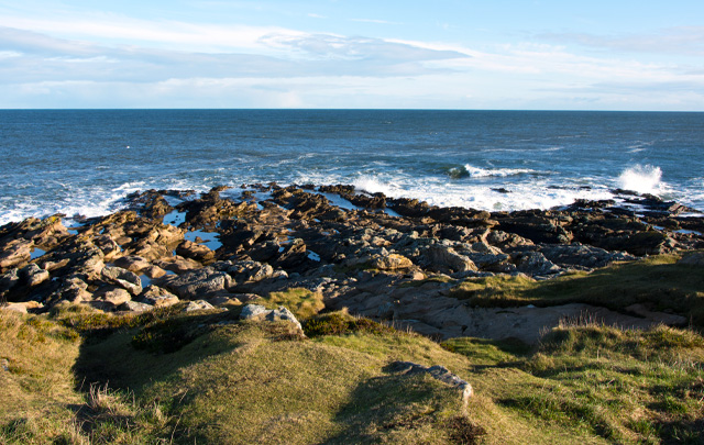
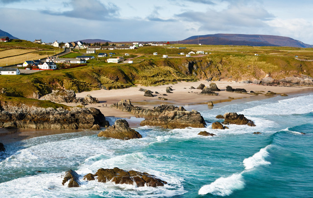
EAST COAST
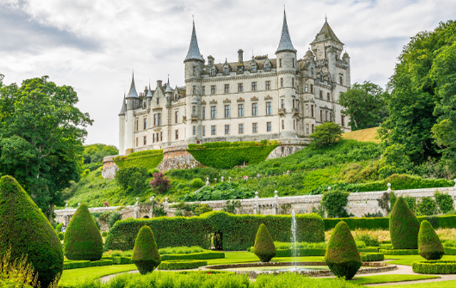
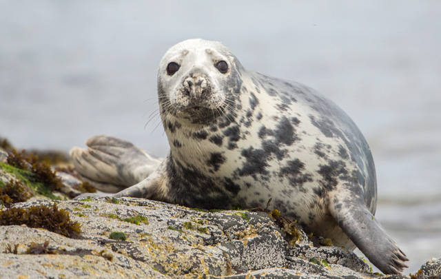
Journey back in time and experience Dunrobin to enjoy the castle, gardens and falconry display. Watch dozens of seals at Loch Fleet, before passing Embo beach on the way to Dornoch or Tain for lunch. The afternoon can be spent visiting Anta & Tain Potteries; and maybe even a whisky distillery too.
100 miles
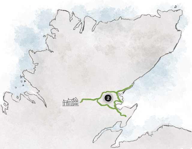
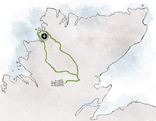
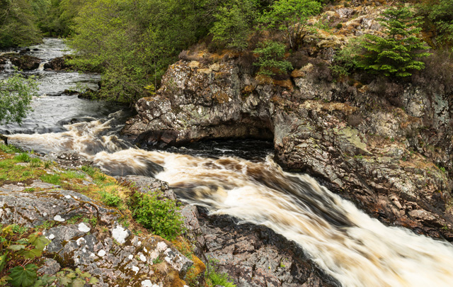
LOOP TRACK
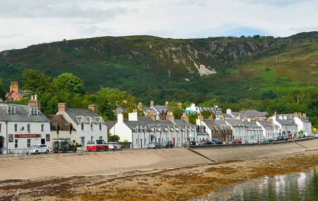
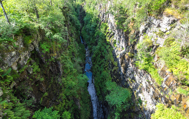
Driving west from Bonar Bridge, you pass Oykel Bridge on the way to the pretty sea port of Ullapool and its extensive selection of shops, eateries and pubs. After a lunch and a walkabout, explore Corrieshalloch Gorge and Falls, before driving onto the Victorian village of Stathpeffer for tea. Finally, take in the stunning views north and west from the Struie Hill lookout point.
136 miles
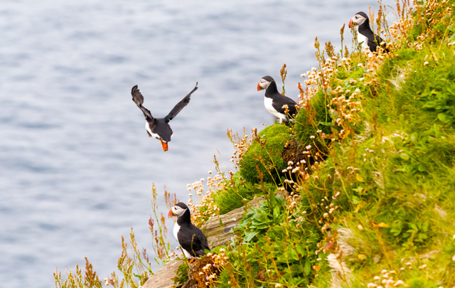
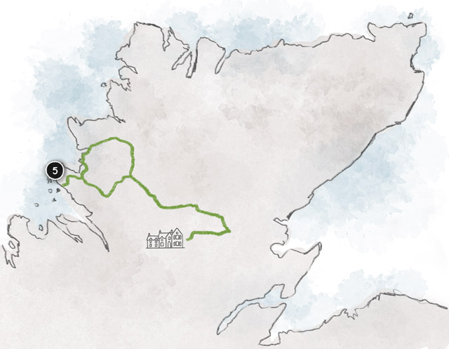
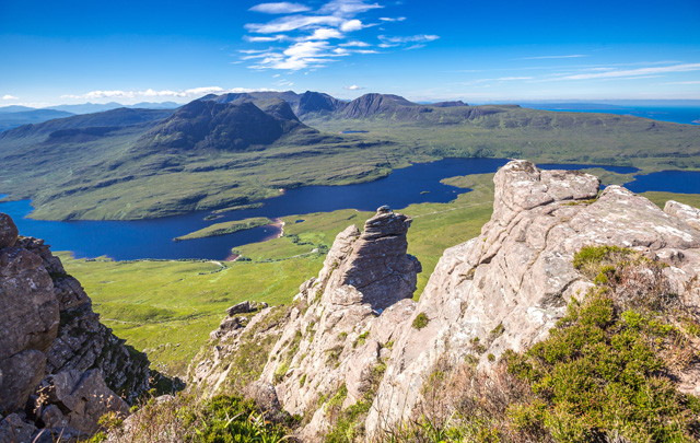
HANDA ISLAND
Visit the Falls of Shin and the salmon leap, before making a coffee stop along the shores of Loch Shin. Take the tiny ferry transfer to Handa Island and get close up to puffins and 1,000s of sea birds. Stop at the local pub in Tarbet for an amazing seafood meal, before heading back to Alladale via Oykel Bridge.
140 miles
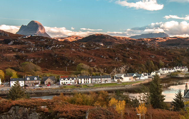
WEST COAST
Drive west, via Oykel Bridge, to the small fishing port of Lochinver and visit the amazing pie shop. Head south along the tiny single track road to Achiltibuie and the Summer Isles. After a possible kayak trip, walk along Achnahaird Beach before driving back to Alladale – passing the majestic Stac Pollaidh on route.
145 miles
WILD NORTH WEST
After a little over an hour’s drive, stop for breakfast at the Altnaharra Hotel before driving further north to the incredible seascapes of the UK’s Top End. Stop at the villages of Tongue or Durness for lunch; or head directly for a pre-booked tour of Cape Wrath and the towering cliffs. Head home along the shores of Loch Shin.
200 miles
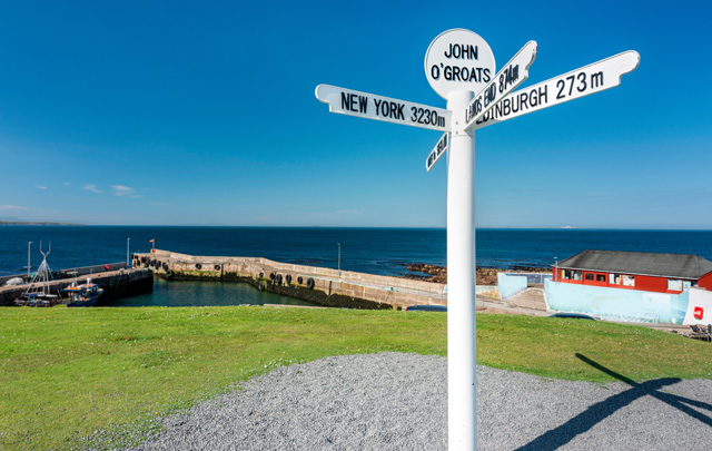
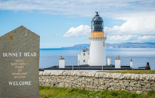
JOHN O’GROATS
After a 90 minute drive, stop for breakfast at the River Bothy in Berriedale – before continuing along the coast to Wick and onto John O’Groats, the most northerly point of mainland in the UK. Take a walk out to Dunnet Head and explore Thurso, before having a late seafood lunch in Scrabster. Head directly back to Alladale via the flow country.
235 miles